
Tree Inventory
What is it?
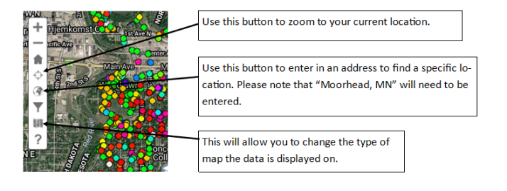
The City of Moorhead utilizes a software called TreePlotter to monitor and manage publicly-owned trees in the City. Open the site and use the icon navigation bar to look through the inventory.
How to navigate on the TreePlotter:
- Target Icon: Zoom in on your current location
- World Icon: Find a specific location. When you enter an address, be sure to include, "Moorhead, MN"
- Map Icon: Change the type of map the data is displayed on
(for reference, see a visual of the icons and functions below)
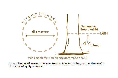
Residents will be able to view the species and dbh of any public tree. Dbh refers to the diameter at breast height, illustrated in the graphic below. There are over 27,000 trees that the city manages, and they are on a 10 year pruning and inventory cycle.
Why is the inventory important?
The inventory is a very useful tool that allows Forestry to keep track of the condition, size, and work needed for all of the public trees in Moorhead. Dbh is a useful indicator of the value of a tree, since this allows for an estimate of biomass, pollution removal, carbon storage, and water retention capabilities. An accurate inventory also helps Forestry diversify the urban forest more efficiently. Diversity helps make the urban forest more resilient against new pests and diseases. Forestry is working to incorporate many new species along the boulevard to enhance the beauty and health of the urban forest. Below is the current makeup of the Moorhead urban forest.

Displayed are the number of trees in each genus in the City of Moorhead. Please note that the scientific names for the genus were substituted for broad common names to allow for easier understanding for the general public. The first 4 categories in blue each make up over 10% of our urban forest.